Specialization Course in Geoprocessing
NUPAD Research Group at the State University of Pará (UEPA)
Area of concentration: Geoprocessing and Remote Sensing
On
In this sense, the research group NUPAD (Nucleus of research applied to regional development) of the University of the State of Pará offers the academic community the Specialization Course in Geoprocessing , with its 1st. class at the Campus of Parauapebas - PA, through the UEPA Agreement with the Municipality of Parauapebas. Below you will find information about the subjects and the main professors of the faculty of the course.
Subjects
Geoinformation and Basic Digital Cartography
Spatial location and implications for geoprocessing. Forms of representation of spatial data. Characteristics, models and structures of spatial data. Basic concepts of cartography. Fundamentals of systematic cartography: earth representation, geodetic reference systems, coordinate systems, cartographic projections, topography and scale. Data conversion, time zone adjustments, standardization. Operating principles and use of orbital platforms in global positioning.
Geographic Information Systems
Introduction to Geographic Information Systems (GIS) – Definition and components. Acquisition and manipulation of data in vector form. Vector data analysis operations. Storage and manipulation of alphanumeric data. Databases. Open Source applications in the field of GIS.
Remote sensing
Physical principles of Remote Sensing (SR); Characteristics of RS data acquisition systems; Main existing SR systems and the characteristics of the data and images generated; Spectral behavior of Earth targets; Methods for extracting information from RS data; Visual interpretation of SR data; Introduction to Digital Processing of SR Data; Introduction to programs and algorithms for RS data processing; Orbital SR applications in land cover and land use mapping.
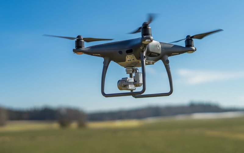
UAV's - Acquisition and processing
Introduction to UAVs (Unmanned Aerial Vehicles) and their applications in the acquisition of geospatial data. Fundamentals of aerial photogrammetry and remote sensing applied to UAVs. Types of UAVs and their sensors (cameras, lidar, etc.) and their characteristics. Flight mission planning with UAVs. Principles of data processing obtained with UAVs. UAV data processing software. Data analysis and interpretation. Practical applications and case studies: precision agriculture, environmental monitoring, natural resource management, among others.
Spatial analysis
Main spatial analysis techniques: interpolation, proximity analysis, network analysis, multicriteria analysis, cluster analysis, correlation analysis, among others. Tools and software for spatial analysis: Google earth engine, QGIS, among others open source. Practical applications of spatial analysis in geoprocessing: environmental analysis, urban planning, natural resource management, epidemiology, among others. Integration of spatial and non-spatial data in spatial analysis. Visualization and communication of spatial analysis results: thematic maps, diagrams, graphs, among others.
Geoprocessing - applications in urban planning
Analysis and evaluation of case studies of Geographic Information Systems applied to urban planning. Considerations on regional and urban development. Present real cases and practical applications of geoprocessing solutions in urban management. Geoprocessing applied to characterization and urban planning, selection of sites for the implementation of sanitary landfills, among others.

Geoprocessing – applications in Sanitation
Introduction to geoprocessing and its applications in environmental sanitation. Data and information on water supply systems, sewage collection and treatment, management of rainwater and solid waste. Geoprocessing tools applied to the planning and management of environmental sanitation. GIS as an aid in the management of sanitation data. GIS functionalities for managing information on environmental sanitation. Analysis of spatial information through thematic maps for visualization of sanitation data. Macro vision of the distribution of the water supply and sewage network for decision making.

Geoprocessing - Applications in Environmental Analysis and Planning
Theoretical-conceptual approaches on environmental analysis in the context of geoprocessing and remote sensing. Presentation of practical problems such as analysis of landscape fragmentation, management and environmental perception, mapping and analysis of urban areas, among others. Geoprocessing applications for: zoning of areas in need of protection, creation of management plans, inspection of legal protection areas, environmental analysis, identification of potential areas for tourist activities.
Imaging Radars
Evolution of Radar. Properties of Electromagnetic Waves. Radar principle. Real Aperture Radar. Geometric Effects. Interaction with Objects. System Parameters. Target parameters (Roughness, Dielectric Constant and Geometry). Radiometric Calibration. Synthetic Aperture Radar. Operating Modes. Polarimetry. Radargrammetry. Interferometry. SAR Image Processing. Filters and Fixes. Introduction to SNAP Software.

OTHER ACADEMIC SUBJECTS
Research Methodology Seminars in geoprocessing and remote sensing Completion of course work (TCC)
Teachers
Norma Ely Beltrão
UEPA teacher
Postdoctoral in Remote Sensing at the Faculty of Sciences of the University of Porto (FCUP), Portugal (2017-2019), PhD in Agricultural Economics at Justus-Liebig-Universität Giessen in Germany (2008), recognized by the Federal University of Rio Grande do Sul (UFRGS) with a PhD in Rural Development, a Master's in Production Engineering from UFSC, and a degree in Civil Engineering from UFPA. Develops research in the areas of Regional Development, Environmental Policy and Management, Environmental Economics, Environmental Valuation, Ecosystem Services and the use of Geoprocessing and Remote Sensing methodologies to identify environmental variations in the Amazon territory using the following tools: QGIS, SNAP and Google Earth Engine.
Rodrigo Rafael Souza de Oliveira
Professor UEPA
PhD in Environmental Sciences from the Graduate Program in Environmental Sciences. Master in Environmental Sciences by the Institute of Geosciences (UFPA). Specialist in Geoprocessing and Georeferencing from Cândido Mendes University. He has a full degree and a bachelor's degree in Geography from the Faculty of Geography and Cartography, Federal University of Pará. Professor at the University of the State of Pará (UEPA). He has experience in analysis, processing, interpretation and systematization of spatial data in the areas of Geoprocessing and Remote Sensing. With an emphasis on the application of geotechnologies to analyze the dynamics of land use and environmental vulnerability in the Amazon and Cerrado Biomes.
José Alberto Sa
Professor UEPA
Post-doctorate in Geoinformatics at the National Institute for Space Research (INPE), PhD in Electrical Engineering and Masters in Civil Engineering from the Federal University of Pará (UFPA), Graduated in Civil Engineering from UNESPA, currently known as the University of the Amazon (UNAMA). works in research areas: Artificial Intelligence; Data Mining (Data Mining); Geoinformatics (Geoinformatics); Digital Marketing and Neuromarketing; Energy, Environment and Sustainability; Civil Defense and Atmospheric Discharges and Forensic Sciences.
Carlos Benedito Gutierrez
Professor UEPA
PhD in Environmental Sciences in the area of Climate and Socio-environmental Dynamics in the Amazon from the Federal University of Pará - UFPA (2022). Master in Environmental Sciences from the State University of Pará - UEPA (2016). Specialist in Technical Support for Computer Systems at the Federal University of Pará - UFPA (2005). Graduated in Technologist in Data Processing from the Federal University of Pará - UFPA (1991). Bachelor's degree in Nautical Sciences from the Merchant Marine Officer Training School - EFOMM (1984).
Renata Melo e Silva de Oliveira
Professor UEPA
PhD in Engineering and Industrial Management from the University of Porto (2018). Master in Production Engineering from the Federal University of Santa Catarina (2007) and graduation in Production Engineering from the State University of Pará (2005). She is currently a titular advisor to the Regional Council of Engineering, Architecture and Agronomy (Pa), partner - Advances in Cleaner Production Network, research assistant at the Institute of Systems and Computer Engineering, Technology and Science. He has experience in the area of Production Engineering, with an emphasis on Operational Research, working mainly on the following topics: sustainability, climate change, environmental services, multicriteria decision support analysis and covid-19.
Carlos Jorge Nogueira de Castro
Professor UEPA
Doctor in Geography by the Graduate Program in Geography (PPGEO/UFPA), working in the line of research Landscape Dynamics in the Amazon. Leader Researcher of the Cartographic Study and Observation Group of the Amazon (GEOCAM), linked to the State University of Pará (UEPA), with Research in the Areas of Transport (Urban and Rural), Cartography (Analog and Digital), Planning and Management. Assistant Researcher with the Group: Territorial Planning, Urban Space and Violence in the Amazon Linked to the University of the State of Pará (UEPA), with research in the areas of: Territorial Dynamics and transformations in space in the areas of mining, metallurgical and infrastructural projects and Land use planning.
Luis Waldyr Rodrigues Sadeck
external teacher
PhD student at PPPGCA/UFPA. Master in Environmental Sciences by UFPA. Specialist in Geotechnology by IESAM. Graduated in Geography from UFPA (Bach. and Lic.) and graduated in Geodesy and Cartography from CEFET-PA, He has experience in the area of Geography, with emphasis on Physical Geography, working mainly on the following topics: Monitoring of forest cover, Geoprocessing and GIS , Remote Sensing and Digital Image Processing, Cartography, Territorial Planning, Environmental Dynamics and Planning, Landscape Ecology and Land Use and Land Cover Monitoring (LULCC). He is currently a GEO consultant at Solved - Soluções em Geoinforma- tion.
Schedule
Period: March 13 to 18, 2023 Prof. doctor Rodrigo Rangel
Period: April 10 to 15, 2023 Prof. MSc. Luiz Sadeck
Period: May 15th to 20th, 2023 Prof. Dr. Ismael Matos da Silva
Period: June 12 to 17, 2023 Prof. Dr. Norma Ely Santos Beltrão
Period: August 07 to 12, 2023 Prof. Dr. Carlos Gutierrez
Online seminars will be offered addressing a topic included in the area of Geoprocessing and Remote Sensing at a frequency of 2 to 3 times a month. Here in this agenda you will be informed of the title of the Seminar and the professor/professional invited to speak.
Contact
- Belem, Para, Brazil
Artigos aceitos no XX SBSR - Simpósio Brasileiro de Sensoriamento Remoto
Autores: mestrandos/doutorandos e pesquisadores do Grupo de pesquisa NUPADGeo PPGCA- Programa de Pós-graduação em Ciências Ambientais/UEPA - Universidade do Estado do Pará
EVALUATION OF THE USE OF SPECTRAL INDEX FOR LAND COVER MAPPING IN MINING AREAS IN IPIXUNA DO PARÁ (PA)
Land cover change is the main theme correlated with environmental sustainability. The applied study in the mining areas of Ipixuna do Pará is important to measure spectral indices. The objective of this article was to analyze Landsat images between 1991 and 2021 and to correlate the: Normalized Difference Vegetation Index (NDVI), Soil Adjusted Vegetation Index (SAVI), Edified Normalized Difference Index (NDBI) and the Water Index by Normalized Difference (MNDWI), in order to classify different types of land cover. The supervised classification was analyzed with Random Forest algorithm, in Google Earth Engine (GEE). The results revealed different changes in land cover with different values for each index, with overall accuracy of classified images ranging from 81% to 89%, respectively. The results showed that these indices are reliable for mapping and monitoring land cover changes in the municipality. Keywords — NDVI, SAVI, NDBI, MNDWI
MULTITEMPORAL ANALYSIS OF THE NDWI INDEX APPLIED TO SOYBEAN CROP IN THE ARAGUAIA-TOCANTINS BASIN REGION (PA) USING GOOGLE EARTH ENGINE
Efficiency and agility in monitoring agricultural impacts on the environment are attributes increasingly demanded by society. Remote sensing in agriculture can contribute to the understanding of these phenomena and enable quick responses to these events. In this sense, the objective of this work was to present a multitemporal analysis of the water content in the leaves of the soybean crop around the Araguaia Tocantins watershed, in the southeast of the state of Pará. For this, the NDWI (normalized difference water index) water index processed through the GEE platform was used, using images from the Sentinel-2 collection in the period from 2018 to 2022. The average NDWI values captured in the samples with cultivation of soy were sensitive to the different stages of crop development. The mapping of the NDWI index can be used in conjunction with other indices to select and quantify areas that are being cultivated, monitor impacts and assist in decision making. Keywords — Agriculture, Remote Sensing, Amazon
USE OF SENTINEL-2 IMAGES TO EVALUATE AGRICULTURAL EXPANSION IN THE MUNICIPALITY OF SANTANA DO ARAGUAIA (PA), USING GHG
Faced with the expansion of soy cultivation in areas of the Legal Amazon, this work aimed to explore ways to identify soy areas using vegetation indices applied to the municipality of Santana do Araguaia-PA, in the years 2020 and 2022. images of the Sentinel 2 constellation processed through the Google Earth Engine (GEE) cloud computing tool. The present work exposes the implementation through source code of the vegetation indices (NDVI and SAVI) and land use and land cover classification with the Randon Forest algorithm. The results indicated that the values obtained for vegetation indices showed good results for areas of natural vegetation, and also proved to be effective in discriminating areas of agricultural crops (soybean) validated by the Kappa index. A study comparing the application of other vegetation indices to a longer period of years is recommended. Keywords — Vegetation indices, cloud computing platform, agricultural areas, soybeans, land use and land cover.
FLOOD IN MARAJO ARCHIPELAGO: SEASONALITY ANALYSIS IN EXTREME YEARS THROUGH SAR DATA PROCESSING IN GOOGLE EARTH ENGINE
Seasonal floods in floodplains are natural phenomena that occur along the Amazon basin, but they can be potentiated by the occurrence of El Niño and La Niña phenomena that favor the decrease and increase of precipitation, respectively. In this work, we sought to analyze the differences in flood areas in periods influenced by these climatic phenomena in the Marajó archipelago (PA). The methodological approach was to detect changes by comparing images before and after the occurrence of floods in each seasonal period 2016/2017 - influence of El Niño - and 2021/2022 - influence of La Niña. Time series data from C-band SAR Sentinel 1 processed through the Google Earth Engine (GEE) platform were used. Results point to larger flooded areas in the period 2021-22, affected by La Niña. Studies of this nature can help decision makers to map patterns in seasonal floods and prevent greater impacts on the population in a situation of socio-environmental vulnerability. Keywords — floods, radar, Amazon.
LAND USE DYNAMICS IN THE TRÊS ARAGUAIAS REGION (PA): SPATIAL AND MULTITEMPORAL ANALYSIS OF IMPACTS ON ECOSYSTEM SERVICES
The objective of this study was to analyze the losses of ecosystem services (ES) of the regulation type in the region called “Três Araguaias” (PA), as a consequence of the dynamics of land use and land cover. Data from the MapBiomas Collection 7.0 project were cut for the study area in three time frames: 1988, 1996 and 2021. The binary matrix method was used, combining different classes of use and coverage to an index of supply capacity of each SE . Results showed that a good part of the SE supply capacity changed the status of high supply capacity to no supply capacity. The methodology presented was satisfactory in showing that forest fragmentation in the Três Araguaias impacted the provision of SE regulation in a negative way. The method used allowed spatialization of the capacity of each class of land use to provide the analyzed services, also allowing to quantify its metrics. Keywords - Agriculture, Deforestation, Geoprocessing, Landscape, Regulation.
USE OF MACHINE LEARNING ALGORITHMS FOR IMAGE CLASSIFICATION AND EVALUATION OF ENVIRONMENTAL DEGRADATION ON THE ISLAND OF COTIJUBA (PA)
Recognizing the importance of remote sensing to assist in the monitoring and analysis of degradation dynamics, this work aimed to estimate the forest degradation that occurred on Cotijuba Island - PA under the approach of forest cover loss. For this, through image classification, the maintenance and reduction of vegetation cover in the study area in the years 1989 and 2021 were identified. Landsat series multispectral images were collected, equivalent to the years 1989 and 2021, with subsequent processing and classification in Google Earth Engine (GEE) using two supervised classification algorithms available in GEE: Classification and Regression Trees (CART) and Random Forest (RF). Despite the deceleration of forest degradation shown in the results, over the last 32 years the island's vegetation cover has shown a significant reduction, with an approximate average value of 18% loss. Keywords — mapping, sensing, Landsat